Experience clean lakeland area
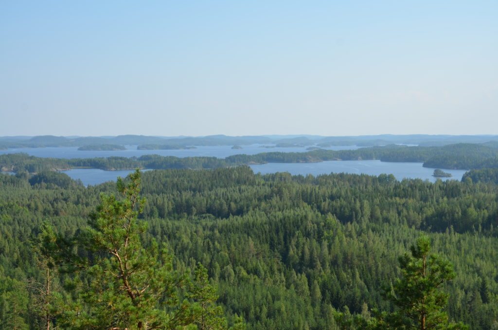
The rocky islands and shores of Luonteri have cliffs several meters high. They reflect the ancient regional fractures and fragmented areas of the bedrock, which stand out well, as during the repeated glaciation of the ice age, the excavation work of the continental ice sheet was most strongly directed at the weakness zones of the bedrock. The continental ice sheet flowed from northwest to southeast and is still visible as an orientation of the terrain in the Luonteri landscape.
Varteussaari (Vartiosaari in some maps) is a good example of the barren rocky island of Luonteri Lake. It is a rocky island of about 1 km2 in the southwestern part of the Luonteri. To the east, and especially to the northeast, the island is surrounded by extensive open waters. There are narrow straits on the north and west sides of the island and the shores are protected by nearby rocky islands. A Varteus excursion harbour has also been built in a sheltered bay at the northern end of the island.
Information on Luonteri’s excursion harbours can be found on Metsähallitus’ Luontoon.fi service (in Finnish)
There is a Saimaa Geopark sign in the harbour of Anttola, which tells about the geology and sites of the area.
Three panels in the sign open up different contents on your mobile device (a series of panels beginning with the title “Discover the hidden treasures of Lake Saimaa”). You need the free Salmi AR app to view the content. Content includes pictures, videos, audio narration, and peepholes. You’ll find information about Suvorov’s time, wartime, and industrialization, and get to see what the area looked like 11,000 years ago and how the ancestors lived. The contents are currently available only in Finnish.
Luonteri’s highly oligotrophic and clear lake is a Natura 2000 site. Botanically, it is a type of reed lake. The Luonteri is also a habitat for the Saimaa ringed seal. The forests in the area are mainly barren rocky pines and the area is important for the protection of old-growth forests. More information on Luonteri’s Natura area can be found in the Finland’s environmental administration’s online service (in Finnish).
Image: Jari Nenonen
Coordinates
Geographic coordinates
61.636228437, 27.828382123
GPS-devices
x= 543904 y= 6833936