Experience the esker ridge that connects the capes
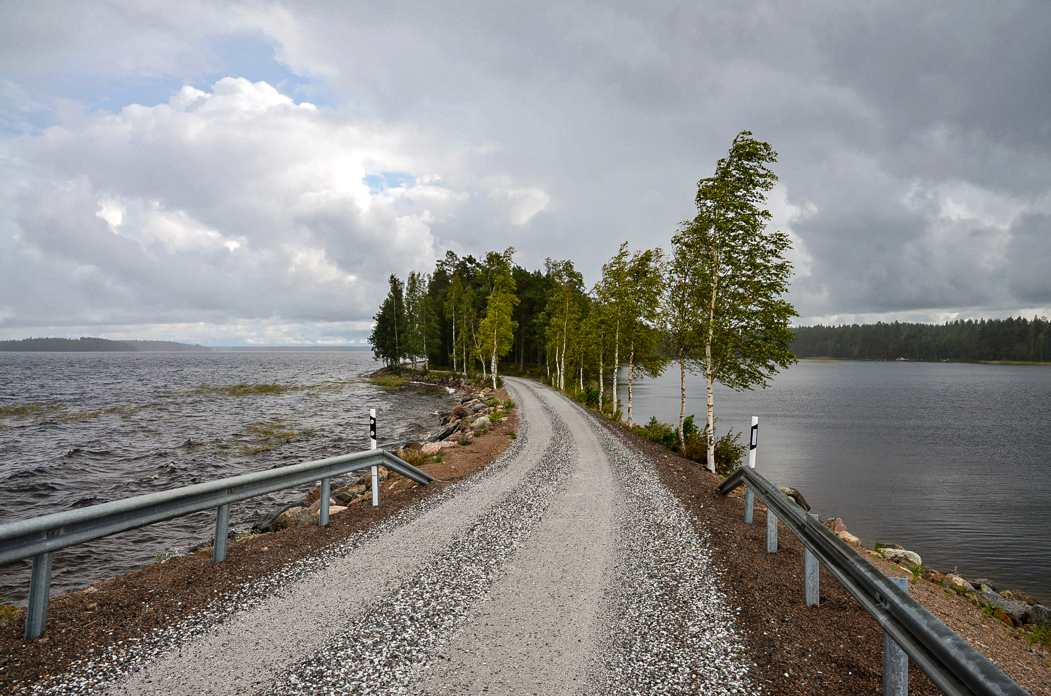
The site encompasses a narrow and uniform core esker ridge system and several surrounding esker expansions. At the top of the esker is a road with fantastic views over the waters below. The area contains ancient shorelines representing Greater Saimaa’s highest stage which were formed around 6,900-6,300 years ago when the water was approx. 6 metres higher than today’s water level. At that time there were only a couple of esker tops, a few rocky hills and possibly the top of an esker platform protruding above the surface of the water. The area also contains some partially paludified kettle ponds.
Suomalansaarentie road passes over the esker ridge between Ketvelinniemi and Kermanniemi. When driving along Suomalansaarentie in Rahikkala village, you are in Saimaa Geopark natural and cultural site. A worthy stop in Rahikkala is the old windmill. When you reach Ketvelinniemi, the landscape changes as Suomalansaarentie passes over a narrow esker ridge and waters of Saimaa are very close to both sides of the road.
Image: Timo Huttunen
Coordinates
Geographic coordinates
61.328570322, 27.837363604
GPS-devices
x=544820,093 y=6799673,266