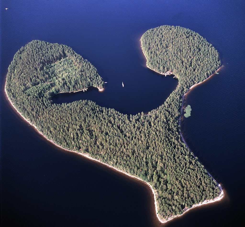
Satamosaari island, magical lagoon
Satamosaari is part of a delta formation whose deposits were shaped by a number of ice blocks. Satamosaari’s lagoon-like bay, for example, indicates the location of a chunk of ice during the deposition period, and the island also features a few kettles. The ancient Greater Saimaa shoreline (80msl) is visible along the island’s entire shoreline.
Satamosaari is a recreation site of the South Karelian Foundation for Recreation Areas. The island has a harbor, three campfire sites, two saunas, a Saimaa Geopark sign and instructions. Cruises from the Imatra are being organized to Satamosaari. Otherwise, the island can only be reached by boat or canoe.
Satamosaari is one of the destinations in the From Ancient Sea to Saimaa trail. You can find the From Ancient Sea to Saimaa route description and instructions for arrival from the contents of the Outdoor Active platform.
Image: Arto Hämäläinen
Coordinates
Geographic coordinates
61.194573494, 28.557257047
GPS-devices
x=583704,351 y=6785456,990
